I have lived on or around
Hwy 47 in Oregon for the past 10 years, been in Oregon since May 13th, 1977. it was a Friday.
I am taking a long road trip, circling America in a 2000 Honda Insight. I will be posting often, making notes of the day traveled, local food, and local politics.
Wildwood Cafe, 319 N.Baker Street., McMinnville
Great little cafe, serves wonderful breakfast and lunch.
Biscuits & Gravy, Homemade bread & jam, good selection of omelettes,organic coffee, lots of vegi options. decent prices,too.
Lunch there good soups, fresh-cut fries, burgers using local grass fed, free range beef. Ruebens, melts, cold and hot sandwiches, salads, too.
That gets you going to
Hwy 47 and beyond.
April 26Car's name is
Skate112,968 miles driven. Life in the country, does require some driving.
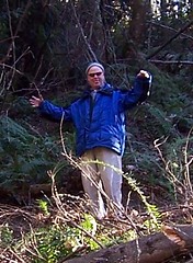
Hwy 47 is some of the most beautiful country I have seen, not taken anything away from all the places I plan to visit.
Here we go!!! turning left out of Kim Wick and Jeff Ward 10 acre farm, they have been kind enough to let me stay with them, while trying to finish the stupidish thing I have been a part of, a divorce. It's not wise to be stubborn, if so, the lawyers will love you.
Light drizzle, Oregon Sunshine.
I never have turned left out of thier driveway, my life has been to go right to the western valley, Portland and south on Hwy 47. Like water I have been going downstream.
Vernonia12.5 miles north, the Nehalem River runs though this town, almost took it downriver in the Great flood of 1996. 10 churches listed at the gateway, welcoming you. Nice little rural town.
Hwy 47 winds and winds to the bottom, where you find the Columbia River and the town of Clatskanie.
Stopped for gas, $2.89, in Oregon, other people pump your gas, yeah!
the attend told me the motorcylist that fly up and down this road call it "the Spine of the Dragon".
Clatskanie to Westport, taking the ferry across, only one I know on the Columbia.
Ferry's name is Wahkiakum, been crossing since 1964, then another ferry before that.
Washington side, town of Cathletamet, State road 409 to Hwy #4, runs from Longview to Hwy # 101, little towns, Skamokawa, sign says" Go Mules", then Gray's River, not sure if it's a town, but they have an Irish Pub, need to go back. Then Rosburg, then side road to Altoona, the same spot Lewis & Clark group said " we are all wet and disagreeable" then they went to Oregon for more of the same. Ave. Rainfall 120"
On to Hwy #101, great road, more later.
Hungery need to stop, found a local spot north of Willipa, S. of Aberden called
Clark'swww.clarksrestaurant.com
Giant Hamburgers, fresh thick w/skins french fries, home made icecream, the Best milkshake I have had in years, home made soups and pies, with a counter to sit at,too.
Full and sleeply, the food and the road.
Onward to see Maureen and Tom on Bainbridge Island, to start this blog, r&r, time to do stuff I need to do, like set up the tent before I am on the North Washington coast with the wind.
Hwy # 107 to #12 to #108 to #101 again, it loops the Olympic Mountains, then to #3
which at 6pm puts you going the right direction, since the other way is everyone comuting off the ferry home on this island, they seem happy and removed and going home. Not sure I could do this, but I have been driving a good distance to work and back fir some time. I guess it's all relative.
Day 1, Skate performed better than expected, 63.2 mpg/ 264.6 miles in 8 hours.