Wednesday, May 24, 2006

Alien Forms, true and not seen!

Reporting from Roswell
Forth of July Weekend, Annual UFO festival
The Roswell Informer, just off the wire reads:
Humans, refuse to accept lake has no bottom, “It must have a bottom”’ explained one bewildered human”, “then how does all the water stay in?”
“Roswell’s four mild make it perfect vacation destination for any specicies”.
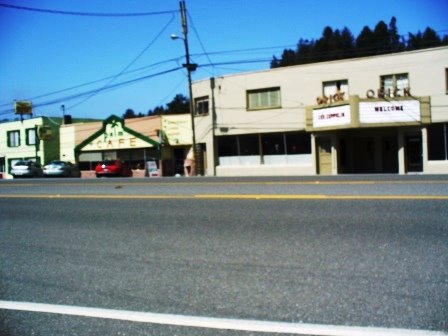
Roswell, nice town, obsessed by UFO’s.
There are numerous OFO museums, research centers, and shops here, the locals tell me when the visitors come for the UFO festival, and they hide like good humans would when invaded. Remember “War of the Worlds”.
A few eateries, mainly Mexican and the /cowboy Café, must be one in every SW town, stopped at the Heavenly Coffee shop, nice folks, they have internet access. I even left with some day old muffins and cherry turnovers. Good camping food.
Heading south on SR 285, long, dry, hot road, not much to look at.
Destination Carlsbad Caverns, this has been on my agenda, from the start.
Stopping in Artesia, been told about La Fonda Mexican restaurant, all you can eat buffet, it’s OK. Like the old days, when I was younger, camping for weeks, we would go to King’s Table, eat enough for a few days.
Carlsbad Caverns 2pm, just in time to do the whole thing, they say they will turn the lights off. Got a pamphlet in Spanish.
A Mescalero Apache legend tells of a tribal medicine man who was last seen disappearing into the darkness of the cave, beating his medicine drum.
The Apaches make annual pilgrimage to leave food offerings at the cave entrance.
Local ranchers attracted by bats flying out of this hole in the ground, found this entrance in the 1880’s.
The Miners explored the cave in their free time. The curiosity of one man carried him far into the cave. The stories of fabulous sights bought more & more people to see the underground wonders.
Carlsbad Caverns National Monument was established on Oct. 25, 1923.
800,000 years ago, caves started to form, the Big Room is the largest natural limestone chamber in the U.S. with a length of four thousand feet, a width of 625 feet and its greatest ceiling height of 255 feet. It covers 53 acres. There are great wonders to look at. It takes about 3 hours to walk though, take lots of batteries for the camera, I ran short of the Big Room, a bought the DVD to look at later.
Wonders that take thousands of years, our lives are so short to nature’s wonders.
BATS, every evening you can watch thousands of bats, thick as smoke funnel out of the cave. Sixteen species of these amazing flying mammals have been identified in the park. The most common is the Mexican Freetail.
The formations are a fest for the eyes! Well worth the trip, plus it’s 56 degrees always.
Sitting here at my camp, drinking Roswell Alien Amber Ale, not bad for Alien Beer.
Into Texas, my birthplace, south of the Caverns is Guadeloupe Mountains Natural Park. The tallest mountain in Texas,8749 feet.
Down hill from here.
Beautiful campgrounds, sitting between Hunter Peak and Guadalupe Peak, birds chirping, cactus is blooming and only a few bugs.
There are mountain lions, so watch the little ones, or not.
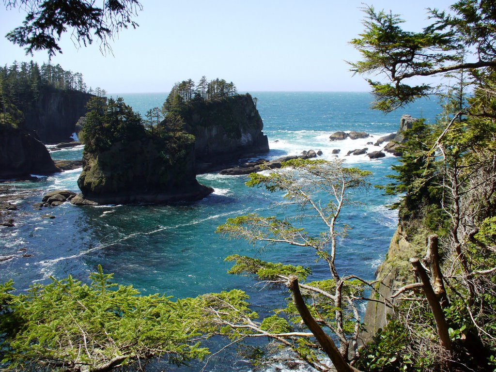
The desert, the bloom of the cactus flower…the thunder cloud, light show of a summer storm…the howl of a coyote at dusk..a lizard barking in the warm morning sun…
A good way for to start my journey into the Motherland.
Across Texas West to East.
May 22, 2006
58.0 mpg/ 165.7 miles travels

Monday, May 22, 2006

Eden to Aliens!


In the Gila Wilderness,
May 21, 2006
Sadly I have to go. After a breakfast of apple pancakes and scrambled eggs, juice and coffee with all the house guests. 2 more soaks, pay my bill and leave.
Yet another gem discovered!
No mortgage, no bills, life on the road, why not!I take SR 35 out, pass canyons, lodges, over the Continental Divide again, it meanders, flowers are blooming in the mountains, they are in a 2 year drought, extreme fire danger, thanks to the volunteer fire dept., and they are the backbone of safety in America, the unpaid volunteer.
I stop at Mimbres, 2 calls from my kids, sweet. I asked the fellow about a road, he says it’s not paved, Dean had told me about this road, I trust Dean, I ask the owner of the store if he’s from here. He laughs. The road is paved, always ask for more than one opinion on the road.
Pass Hillsboro, NM, the whole towns for sale, even the 1827 grocery store.
Location, Location, Location!
Down SR 27, the road has gravel, and cattle, open range, pass a ghost town Lake Valley to the Jct. of SR 26 & SR 27 where the “Middle of Nowhere Bar” is, by the way, it’s for sale too.
Long drive to Roswell and the Bottlomless Lake, pass Las Cruces, Hot! Hot! Hot!,
25 miles from the border, head to Hwy. 70, I need to get around the White Sands Missile Base. Stopped on Hwy 70, for inspection, the young fellow says “looks like you are on a hell of a trip, yes sir I am”. The heat and stop, my engine light is on again, over heated battery cells, will need to have someone reset them, Maybe Austin.
Long drive, quick stop in Alamogordo to tacos, BOOM!
Pass the Mescalero Apache reservation, Fry Bread!
On into Roswell, Sunday evening, not much open, nor any aliens sited either.
In July, they have a parade, the locals run, as alien visitors invade the town.
Last night in the Bottomless lake campsite, me only visitor, turned on camplite, attacked by bugs, lots of bugs.
Lighting in the distance, the smell of rain, and the wind picks up; I have not experienced this in a long time. Camera reading for pictures, the rain never came.
66.5 mpg/ 369.8 miles traveled

" Riding the Spine of the Gila"

“Riding the Spine of the Gila”
Let’s say Silver City is the tail of the Gila, take SR 15 N, 44 miles, blacktop road, one lane each way to Pinos Alto, after that blacktop wide enough for a car and a-half.
You can see the back of the car on numerous curves, you try to peek around each bend for others, you are climbing, switching back & forth, no guard rails.
Jct of SR 15 & 35, you climb again, with great views of the Gila Wilderness area. This is the first designated wilderness in the country. At one point you can see a lush green spot, deep down in the valley. Eden! The Gila River runs 365 days a years, the birthplace of Geronimo.
My plan was to go to the Gila Cliff Dwellings. The earliest ruin is a pit house from about AD 100 to 400, people of this period referred to as Mogollon, grow corn and beans, hunted, gathered wild plants for food. They made plain brown pottery. But most of the Cliff dwellings date back to the late 1200’s. “Cliff Dwellers” refers to Pueblo people who built homes in natural caves. Excellent examples of early homes and lives of Indian culture here.
About to leave, the Park volunteer, our guide for the ruins, told me about the local Hot Springs, it’s on the map, but I had no local knowledge and was unsure of my plans. Driving up here with a ¼ tank of gas, 1 beer, not really prepared.
So I go to the Wilderness Lodge, run by Dean & Jane Bruemmerand, and their 3 sons Joe, Max and Ike. This 100 year lodge was originally a school house in Hurley, NM. In the 60’s a man named Coy Rasberry single handedly dismantled and moved it to Gila Hot Springs. It’s now a rustic bed & breakfast with two stone lined soaking pools. I have been on the road for almost a month, I am staying, the first night I was all alone, reading, soaking and drinking my 1 beer.
The second day, did I say I was staying 2 days, 6 others arrived, we talked and soaked, it was good to have prolonged human interaction!
Dean & I, the owner talked a lot, he is also an excellent cook & his son Ike will be someday, he is a good man, he & Jane home school their kids. They live in a house in the back. They leave the guests alone, totally. Perfect host.
Close to here, is a campground $4 a night with artistic found artwork and hot springs. The locals come up here, soak, play music and get away from life.
Paradise found, Eden!
May 19 & 20, riding the Gila!
54.0 mpg/ 141.1 miles traveled

Cowboys & Indians & Miners

Cowboys & Indians & Miners
Leaving Show Low, Arizona after visiting the Historic Center, 2 mayors were selected by drawing cards, A correction, it’s Aunt Nancy not Aunt Maddy's's.
Take SR 60/ 77 W, turn left on SrR 73 to Fort Apache.
Fort Apache or Tl’onk’a’gai: Place of White Reeds.
This beautiful land at the confluence of the North and East forks of the White River has been favored settlement site foe thousands of years. Ndee- White Mountain Apache people- lived and farmed peacefully here for many generations before the U.S. Army in 1870 to establish Fort Apache. Today the Ndee have reclaimed Fort Apache as a place to remember, reconcile and celebrate Apache culture and history.
This is the best reservation I have seen, homes, businesses, and schools. As well as the community, looks to me as a healthy and a respected place.
The White Mountain Apache have a clan system, thee are 62 clans today, 27 active clans, names Butterfly, Roadrunner, Eagle and Bear. They belong to the Mothers clan, as true in Ancient Native cultures.
Welcome!
Ha’an (Apache)
Huvam Yeesee! (Hopi)
Kishi! ( Zuni
)
Also on the reservation are the Kinishba Ruins
Kinishba:Kih Dalhbaa- “Brown House” (Apache)
Mai’Povi- “Place of Snake Weed” (Hopi)
Hesho da so Sona- “Brown House of Ancestors” (Zuni)
Kinishhba Ruins is the remains of a village built and occupied by ancestors of today’s Zuni and Hopi Pueblo tribes. Near by pit houses, indicate settlement here an early as 800AD. Pottery, especially Hopi Yellow Wares and Zuni Glaze Wares, suggest occupation by Pueblo people into the 1400’s.
Around AD 1325, when Kinishba reached, its maximum size of about 600 ground floor rooms (400-800 occupants).
There is no clear evidence of ancient Apache occupation at Kinishba, but oral traditions indicate Apache history in the region extending into immortal, Apache, Hopis, Zunis, and non-Indians’ work together as Kinishba’s stewards.
One poem stands out to me:
Isaa’ the Drum
The round can is the earth.
The buckskin covers on the drum
Is the fanned deer hide.
The water inside the drum is our blood.
The beads inside the drum
Are our beads, male & female.
The rope tied around the drum is veins.
The drum sticks our bones.

The Earth drum-female
The Sky drum-male
I leave with thunderstorm overhead. Not knowing the weather here, I am not sure of rain.
I head north on SR 73, stopped at Hon Dah casino, something a rarely do. It’s been an odd day, thought I would my luck. $10 came and went!
So far I spent $10 in Atlantic City Casino, $10 in Winnemucca, Nevada, and now $10 here. Bye-bye to 2 sawbucks.
Turn Right on SR 260 E, aspen and pine forest, lots of lakes, if I were stay on this highway to New Mexico I would go through Pie Town, located on top of the Continental Divide.
Onward, pass Nutrioso, there a lodge, Tal-Wi-Wi Lodge and restaurant as well as a rustic saloon, rooms have private hot tubs and wood stoves, the last weekend of July is a BBQ and dance. Stopped too eat dinner at Bear Wallow Café, home style food with a big selection of pies, fruit, pumpkin and pecan, great not to sweet. I eat chicken fried chicken and cream gravy, lumpy mashed potatoes and string beans from the can, doctored up with bacon, not bad.
As well as other eateries and topped of by a great local rag called the “Mogollon Gazette”, who’s what’s going on around this part of the woods.
Out of Alpine, looking to camp or sleep somewhere, not much open, don’t really or had not wanted to drive to Silver City, my next stop of interest.
Into New Mexico, I New Mexico, I lost an hour, Arizona doesn’t do Day Light Savings.
Down SR 180 S at night, in the San Francisco Mountains, hoping for a room in Glenwood, only the bar the Bluefoot Café & Bar were open, nothin’ more.
Windy roads at night into the mountains be careful.
Herd of elk, both sides of the road, I see, I stop, I wait, bye bye elk, as they go into the darkness, they are looking for water, dry year here.
Pass Buckhorn, Silver City in the distance. In old town nothing, then to a cheap motel.
67.9 mpg/ 284.4 miles traveled
Going down is good/too many miles, again!

May 19th, gone 23 days.
Silver City, lots of small shops, art galleries, and this town has a good feel, with some embedded poverty. Local Rag “Desert Exposure”, the biggest little paper in the SW, there is an article about NM’s minimum wage, $5.50 per hour, even Dems voted against it in this state.
Blues Festival May 26-28th, I am a week too early.
Walked around abit, the Ballard Street area is cool & funky, Good coffee shops, restaurants and a food co-op.
This town was built on Cooper Mining, lumber, cattle and agriculture, and a diverse population of old Spanish, Native Peoples, New Mexican and Anglos.
Local Hot Stops:
Silver City Grill, were the characters are better than the food. Next store is Daines, were you won’t go wrong and Shevek Mi for lunch or dinner, a good place to purchase wine or micro brews. There is a food co-op 30 yrs. Running and the Java Hut for coffee.
Down the corner on the corner of Rejuvenation coffee, next to the Buffalo Bar, local watering hole, drank, smoke, shoot pool, start early.
There is the Silver City Brewpub, too.
And in Pinus Alto is the Buckhorn Saloon, great food and bar, with music, as well as an Old Opera House next store doing “Billy the Kid”.
Silver City is growing, people coming from elsewhere, this is happening all over the West. Property values are up. “There is no way for me to locate to Silver City without helping to kill the thing I love”. Quote from Spenser Havlick.
Next “Riding the Spine of the Gila”

Thursday, May 18, 2006

St. George Utah to Slow Low, Arizona

St. George to Show Low, May 16th-18th
Cleaned up and shaved, always leave AC on in high hot climate, overnight building continue to carry heat.
Heading for Best Friends in Kanab, Utah. Taking Interstate 15 out of St. George north, to Utah SR 9 E, then Ari. SR 389 to Fredonia, the SR 89 N to Kanab drive short ways north to Best Friends, a sanctuary for abused and abandoned animals, it begin in the late 70’s. There mission is No More Homeless Pets, they afford stray/neuter and adoption programs, you can volunteer for a hour, day or week. I when on a 1 ½ hour tour of Dogtown and Catworld, they also, take care of bunnies, birds, livestock, horses, mules, sheep. This is a wonderful mission of kindness.
Kanab was used to make Hollywood Westerns, cut them off at the past!
Lots of eateries, Escobar’s for Mexican, 3 Bears Creamery, Rewind Diner and the Shady Cove. Lots of Motel sporting, they are the ’motel of the stars.’
Funny local story, after a film shoot, an elderly lady that had been an extra, took home a fake boulder, during a wind storm, it blow onto the road, a man driving sees the boulder slows down, not to hit it. She runs out to pick-up this boulder and puts it back in her yard; the man seeing this runs into a pole, he was ok.
South out of Kanab on SR 89 S to SR 89A, the North Rim is open, take SR 67, much more wooded then the South Rim, less people too. Relaxing drive in, forest and meadows to the N. Rim, more people than I thought, smells of fresh paint, everything, there are cabins and a lodge, Teddy Roosevelt used to frequent this area, the bar’s named after him.
Great outlook by taking the Bright Angel Point, short walk from Lodge, you are 5,780 feet above the Colorado River, which I could not see, spectacular views. Take are hikes out of Point Imperial, 8803 ft. down around the rim. Parks have become accessible to anyone, no more survival of the fittest to see nature. Should all places of beauty be paved to? Thoughts of camping at Jacob’s Lake, so I can push around to S. Arizona, leaving thunderstorms around, I push on. The ranger told me about a place in Vermilion Cliffs, with 100 beers, actually 82. Lee’s Ferry Lodge is Heaven, located down from the N. Rim on SR 89a E, right before Lee’s Ferry, been there since the 1920’s, I walk in, there the beer, there are stone building, each with 4 rooms, chairs outside, friendly dogs on the pouch, the help gets room and board and some change, they are looking for a cook. I have the burger and a beer, should have had the ribs, I hear they are great. Sitting up at the counter, trucks past, cars stop, outside you can tell when a meal is being cooked. Your views of the cliffs and the sky. May have to come back for a short or long stay.
It’s like the movie “Baghdad Cafe”, were you find friendship, reason’s for being and possible love or just the quiet bliss of the desert.
May 16th
66.0 mpg/ 280 miles traveled

May 17th
I leave with thoughts of, is this home. Down to Lees Ferry, it’s a very high bridge over the river, lot’s of river rafter’s start here.
Quote about the river “ Water is to thick to drink and to thin to plow”, the old river before the dam was put in. Now it’s a managed river, never to be like it was. I decide to go to Page to the Mayor Powell Museum, to learn more about the area. It’s a depressing
town of regular America, it’s here because of the dam. I drive down to see the dam, security is important here, I drive on. I am on vacation.
Nice hike out of town of Horseshoe Bend, scary on the top of the ridge looking over.
South of here is Cameron, home of the “Navajo Taco” flatbread, with all the fixings.
I turn Left on SR 160 E to Tuba City, a poor reservation town, high prices, Social Security for everyone, feeling of no hope. I talk to a Hopi woman that moved there in 1957 no electricity then. Now Burger King, KFC, and McDonalds, last time though 10 years ago, it was not this developed, America has learned to engage and exploit all of us with the same products. An easy fast life, were you are hungry an hour later, eating factory food.
I turn Left to get here, I turn Left to go the wrong way, I go 60 miles with the Hopi Villages, sign say four corners, shit, turn around, turn left to go the right way.
Four Lefts to Go Right! Day of wrong turns.
Back to SR 264 up the mountain where the Hopi live, the Hopi and Navajo used to fight, but the Navajo are nomadic peoples and the Hopi grow corn, they have found the need to coexist, for the overall good of all.
Turn right on SR 87 to Homlovi Ruins, too open here to camp, I push on, on Interstate 40, I see Rt. 66, turn of, it’s a shell of the road, the towns are starving now, the road of my parent’s generation, the joy of driving it, are gone!
Holbrook, dusty town, truck and cars fly by, cheap motels, turn south on SR 77, pass Snowflake, pass Taylor to Show Low, to Fool Hollow Lake Sate Park, sun’s setting, too long of a day. It’s a quiet man made lake, only two natural lakes in Arizona.
Went to Aunt Maddy’s for Breakfast in Slow Low, good home cooked, nothing fancy, nor the prices either.
Show Low got its name from a poker game played by two local ranchers in 1876. As local legend has it, Corydon Cooley and his partner, Marion Clack, played a game of seven-up to decide which of them would get the town’s original ranch. The game went all night before a weary Cooley finally told Clark; “ Show low you win”. Clark reputedly pulled a deuce of clubs and said: “ Show low it is”. Lots of the Western stories in the SW.
May 17th 65.8 mpg/ 407.2 miles traveled

Monday, May 15, 2006

Books for the road

blue highways by William Least Heat-Moon, A Jounrney into America
Desert Solitaire by Edward Abbey
The Bible, my late brother's, just in case
The Declaration of Indepedence, just in case someone forgets who we are
The Perennial Philosophy by Aldous Huxley
The Old West by Fodors about the History of Western American
2005 Oregon Tilth, growers and processors
Birds of North America
The Soul of Rumi, translations by Coleman Barks
American Cookery by James Beard
Life on the Mississippi by Mark Twain
Shakespeare, Four Comedies
The Complete Works of William Shakespeare, who is this guy?
The Art of War by Sun Tzu
The Essential Rumi
Al-Qur'an, translation by Ahmed Ali
Who Let the Dogs In? by Molly Ivins
Taste of the Nation Portland Pamplet, by some hard working activists
2 books about Wisconson Restaurants
Numerous Pamplets on electronical stuff I have, can some reset my CD player's time
Maps

Utah and Panguitch, a Culinary Vortex

Utah, Zion & Bryce and Panguitch May 10th-15th
Zion, May 10th & 11th
Sounds of the river, brown and full with mountain stream run-off.
As the sun fades, the mother takes her place, full.
Wind calm to late evening, blusters,
Camp fires alive and dazzling, sparks dance into the night air.
Warm winds of the canyons exhale,
No coolness here.
Jet liners cruise overhead, getting a bag of peanuts and a coke,
Look down to only darkness.
Down here, stillness, quiet, to me,
Coyotes prowl, owls work the night, movement all though out,
on the canyon floor down here.
Angel’s Landing, the sign reads- 5 miles, 4 hours, 1488 ft. ascent, strenuous.
Do not feed the squirrels, named for Walter Reusch, first superintendent of Zion.
21 switchbacks, made in 1924 from Refrigerator Canyon to Scout Lookout.
It’s a great hike up, to the first landing, then you continue to climb to Angel’s Landing by holding onto a chain, at one point you are on a 3 foot wide crossing, straight down to the valley floor. Zion is a bus in park, or drive to or campsite and walk, a few good hikes around the park, some overnighters on the top of the park. Still breathe taking, accessible to most.
Springdale outside the park has grown since I was here last. More restaurants and shops, good eats here, check out the Spotted Dog Café, happened in for a good breakfast before going to Bryce, I had an excellent omelette. I must have known, because on the walls were things like the Gem of Zion. Dinner items like Braised Achiote Spiced Lamb Shanks, Local Red Mountain Trout encrusted with pumpkin seeds and Grilled Brie with fire roasted red pepper coulis for starters.
May 12th, leaving Zion, take SR 9 E to SR 89 N, out of the park can take awhile if between RV, on R89 you go though a beautiful valley, this is horse country.
Pass the Adobe Café, best Mexican around to SR 12 E, then SR 63 s
to Bryce Canyon,
Ebenezer Bryce, lived in a cabin above the rim with his wife Mary, when asked about the canyon behind his house, he replied “It’s a hell of a place to lose a cow”Bryce Canyon, my words can not describe this place, you have to see it. My only word-Holy.
Henry David Thoreau 8/14/1854
“I need solitude. I have come forth to this hill….to see the forms of the mountains on the horizon-to behold and commune with something grander than man”
H.D. Thoreau 1/21/1853
“Silence alone is worthy to be heard”
One more point of view: on the Hoodoos, the rock formations here.
Before there were my Indians, the Legend People, To-when-an-ung-wa, lived in that place. There were many of them. They were of many kinds- birds, animals, lizards, and such things- but they looked like people…for some reason, the Legend People in that place were bad. Because they were bad, Coyote turned them into rocks; some standing down, some holding on to others, you can see their faces, with paint on them just as they were before they become rocks…” Paiute Indian legend
The air is thin here at 9100 feet, the sky changes often, thunderstorms then clear in moments. SEE BRYCE. Period!!!
Panguitch, take SR 12 W to SR 89 N,then rt on SR 143 W, it’s Saturday night, the park host, a man named Dennis from Texas tells me of the Cowboy's Smokehouse Café in Panguitch. I had the best BBQ in awhile Smoked Turkey, brined perfectly then smoked,
Pork Ribs and Brisket, coleslaw and the best smokey bacon baked beans, and a Sarsaparilla soda.
And peach cobbler for dessert, this place is worthily of Nation landmark status.
There is also music, I asked” Country or Western”, she says more country. I ask the local gals, what they do around here, they say” work here”, they go down the hill (mountains)
To Cedar City, small town USA, kind of like Gaston. Down the road is the Flying M Café, home of the best Cinnamon Roll, roll, it’s so good, and driving down the mountain, it’s the only thing that did not move, as I drove down the switchbacks to Cedar City. Everything else was in my lap. Except my cinnamon roll!
Leaving Bryce May 15th, the car engine light is still on. I stay up looking at the Milky Way, only place I know where you can see the MW, with a full moon.
Out to SR 12 W, then SR 89 S to SR 14 to Cedar City, pass Aspen forest, lava fields, into Iron County, pass log cabins, still snow here SR 148 still closed, at the summit 9910ft. then down to Cedar City, gas prices here $ 2.96/gal.. I need to travel on Interstate 15 to St. George, the Honda dealer is there, I drive 70 mph, and everyone goes by, everyone.
If you own a Honda Insight, do not cover up the air vents, inside the car, like I did.
I have been over heating my batteries in the back of my car. But I have never gotten as good a as mileage.
St. George, strip mall town, but I have discovered a great little Mexican café.
Always go just a little farther, keep your eyes open, and you too can find a gem.
The numbers:
65.8 mpg, 363.5 miles traveled May 10-15th

Friday, May 12, 2006

On the Extraterrestrial Hwy

May 10th Tonopah
Getting ready to travel “the Extraterrestrial Hwy". with the engine light on!
Take Hwy 6 E, where the trucks still roll, the road is straight as for as the eye can see.
Turn Rt. To the ET HWY. 375 S. This is wild horse country and yes they are here. A small herd of about 8 horses all ages was by the roadside, cool. I did not stop, or feed them Necco wafers, which I love and horses do too. I have not seen another Insight on this trip, damn if one just passed me on the ET Hwy. then to my right I see an antelope running full out, 90 degrees to my right, we will meet if we both continue our routes, he pulls up, I look over, thanks.
While listening to “Secret Agent Man” I pass Rachel, there is the Little Alien Café or Quik Fix Store, and a real Flying Saucer.
Pass Ash Springs the scenery changes, more hilly, and trees on to Rt. 93 to Caliente.
In Caliente is the coolest, the World Famous Hot Spring Motel, there for years, great to stop, you weary travelers. Not able to stay, I stop ask for info, they have remodeled, so not sure about prices.
Then up to Pacaca and into Utah, on Rt. 319 to Cedar City with a detour to SR 56 E, I pass the Last Chance Saloon, it’s boarded up. In Cedar City I am hoping for a cheaper fix for my car. Cedar City is a Hwy town, sitting on Interstate 15, All the regular fare is there. Goodyear runs a test, yes my battery is shot, so they go looking. 115k on the original battery.
They find one, for now the car is fine!
Down Interstate 15 to Zion National Park, arriving early evening for a camp site by the river, looking up at the Waterman, time to set-up camp, the old Boy Scout in me is working, set-up and drinking a beer in record time
I have 14 good beers, Utah sells you weak beer. Is 14 enough?
I have put my faith in Skate, Go Skate Go!
Saw the newspaper today, Bush with his mouth open, looking like a large mouth bass,
talking about your phone records being monitored,it's OK, trust me reminds me of a big bass they will eat a lot of flies if there are no hooks in them.
63.9 mpg, 351.4 miles traveled

Thursday, May 11, 2006

On to Nevada, I think!

May 9th, All the passes are closed, choices are Bakersfield or up tp Rt. 88
The Tioga Pass is closed, still 14 feet of snow.
I retrace my steps north, up Rt. 120, down, down, down. Sometimes I get 69 mpg, then 73 mpg. Old Hwy 120 has a road, Old Priest Road 10% grade, the new is wild, this road is all brakes. Rt. 108 is closed, pass Sonora again, I am going North, towards Oregon, an pass Jimtown Frosty.
Jackass Hill up ahead, it’s the road to Mark Twain’s cabin. He stayed here 12/4/1864 to 2/25/1865, he heard the story at a local saloon about frog jumping. This inspired him to write “Jumping Frog of Calaveras”. On this hill backers would hail as many as 200 jackasses a day. Sonora has a jubelle yearly.
Right on Rt. 88, in a little burger joint called Giant 88, real big double cheeseburger and a malt, it’s after the lunch rush , the cook is eating, she goes behind the counter starts cooking my burger, I forgive you.
Up the mountins, pass snow covered lakes and sky resort cabins, on SR.89, pass a hot springs town called Markeeville, need to stop back there someday. Down a big grade to Rt. 395 S, views of Nevada, and the senery turns to high plains country.
On Rt. 395, running low on gas, I push ahead to Bridgeport, 5 hours to get to the same spot that the pass would have let me off. 200+ vs. 60 miles
Well I get to that spot, Two Lights come on, IMA and the engine light. Need gas, too.
Passing nobody towns, high priced gas, I drive, a little panic sets in, the phone has barely worked on my trip, the Verizon guy needs more help.
The car is running fine, I read about hybrids running without the electric cells,so I may be all right.
Do I know!
At Bridgeport I pull into a Shell $3.99a gallon, then a drive thru town, turn around, there a station at $3.95, there goes two $20’s.
I push onward pass dusty western towns were trucks pass you going 100mph, on to Cal. SR 167, then Nev. Sr 395 to Hawthorne, I had wanted to get to Caliente tonight, but left to late.
I listen to Doc Watson, call Jeff,I tell him where to find my body.
On to Hwy 95S, the truckers highway and cars to Las Vegas, all doing 100mph plus.
I pull into Tonopah, $29.95 a night, good enough for me.
60.3 mpg, 449.3 miles traveled

Yosemite

Sunday May 7th 58.5 mpg, 272 miles traveled Napa to Yosemite
Under Yosemite Falls, a plague at the place John Muir built a sugar pine cabin in 1969.
He writes “ Climb the Mountains and get their good tidings nature’s peace will flow into you as sunshine flows into the trees the winds will blow their own freshness into you and the storms their energy while cares will drop off like autumn leaves.”
May 8th Mirror Lake, under Half Dome, slush greenery, it’s spring in the mountains, water running off every surface, down sides, to the valley floor, waters on the move, huge snow falls and wet winters in the Oregon, Washington, N. California and the Sierras this year.
Everyone was ready for spring, how bought you?
May 1 delivered, still was a bit cool in the NW, warm here, not hot, time to show off my legs!
Life could not be finer here, not a many climbers, I hear late September is good, when the granite cools, less water. There are some climbers here from all over the world.
Camp 4 $5, first come, first serve or the Ahwahee Hotel $395 per night, I am keeping the towels, soap and wall fixtures, please don’t check my bag.
Hiked half-way up Yosemite Falls, that was good enough, over the tree line, for a good view of Half Dome and the rest of the valley.
“As long as I live, I’ll hear waterfalls and birds and winds sing.
I’ll interpret the rocks, learn the language of flood, storm, and the avalanche. I’ll acquaint myself with the glaciers and wild gardens, and get as near the heart of the world as I can” John Muir
My nights were to sit in my chair above the camp,reading, drinking a beer, my view of the Sentinel and the 3/4 moon over head.
Two full days is not enough, it’s time to travel over or around the mountains, and it’s not one's choice, its natures.

Tuesday, May 09, 2006

the Redwoods to Wine to Mountains

Arcata, Saturday Farmers market, old hippies, young hippies, and dreads by the dozen, casual, band plays jam music. The N. Cal coast is removed from civilization, due to isolation of the area, the college, woods, time it that to get out, not to mention that cells phones only roam. Did I talk about the low wages and lack of good jobs for grown-ups. So you have it or you don’t, all fuels good politics. Both sides of the owl!
Leaving town, nice laided back town, like Eugene 30 years ago for me.
Down Hwy. 101, pass Eureka, seems friendly cleaned-up downtown, passing a cool brewery. More later on about eats and drinks.
Ave. of the Giants, 32 miles of 35 mph, getting 63 mpg, sunlight shining thru the massive redwoods, weaving between them, they touch the road, not to close.
A motorcycle ride would be heavenly.
Garberville, having passed there years ago, my memory is of a cool town, it’s seems to be normalized know. The town looked spruced up, yes there are freaks hangin’ at the taco shack. My mind was hanging onto a memory, I have changed, and my town as changed.
On to Hwy 1, on the coast, it’s a slalom run, feel like I was standing on the brake, looking down at the road right below me or gearing up the grades the best I could.
Great ride Hwy 1, beautiful coastline, nice older towns, some have been here over a century and more.
Good bye Pacific Ocean, a look over my should, goodbye.
On to Hwy 128E listening to “Miss the Mississippi & you”.
Though Anderson Valley, grapes here make deep red wines, good zins.
There goes Boonville, the Redwood Café goes by, too.
The back side of this route is like the first part of Hwy 1, a slalom ride, quite fun!
Need to stop, campground in Napa, Saturday night, no problem, when traveling you have to remind yourself of what day it is.
Back on Hwy 101, fast, fast, fast. Gas price don’t slow these forks down.
Down Hwy 128 again, all the great winery. Got lost, stopped at Barbie’s at Alexander Rd. & 128, fun local bar, mix of workers, locals, and tourist.
Trying to beat the sun to the campsite.
Saturday night in Napa, 1 campsite left…$20, the cheapest room in town
61.3 mpg, 277 miles

Sunday May 7th On to Yosemite
Down Rt. 128, pass more great winery, there goes Greystone Culinary school, and
Palm trees! Check out Oakville Store 126 yrs old. Real coffee, treats and all your gourmet needs.
Rt. 128 to Rt. 12e, no way Hwy 80 for a few miles, 4 lanes strong, then back on Rt. 12
Sliding under all the people, this road is a great route to Yosemite from the coast.
On the way NPR the Tippet Bros on, nice to laugh, passing filled churches later listening to Bill Monroe signing ‘Where where you when they crucified Jesus?’
Gentle rolling hills 65mpg, heading to the mountains.
Delta Bluegrass, no festival, just grass. On to Lodi ,Rt. 88 to Rt 49, if one had time drive all of Rt. 49, pass Angels Camp, Mark Twain was here, his picture and name I see, does he have copyright protection?
Pass Jackass Rd. there is the Red Barn Bar, there is trout fishing, and there is the Sportsman Bar, beer, guns, ammo and fishing supplies!
Rt. 49 bto 108, Rt. 120 closed, county rd. 132, more fun then Rt. 1, had to go into 1st gear, I like to run hills gearing going up, no gas,then no brakes, both hands on the wheel going down.
Was getting 65mpg on the valley, losing that now.
Into Yosemite, Sunday afternoon, all campgrounds full,California has a reservation system, be forewarned, but there's Camp 4, only $5. it’s where all the climbers hang out, carry in your gear, short ways, great fun, people from all over the world here.
Yosemite, well worth the visit,just not in season, more later.
Plus a mileage report.

Friday, May 05, 2006

the Elk have it made!


May 4- 5, 2006
Time to chill, went just a few miles today.
The lead for best greasy spoon is now held by the Palm Cafe, located in Orick pop.650. It's open 365 day a year, has great grease, decent prices and the best jukebox I have ever seen. Orick sits in the heart of the Pacific Redwoods, surrounded by elk. The elk are very excited, Led Zeppelin is coming to the local theater. Not sure if ticketmaster has tickets, it's a small theater, so buy tickets now!
Great camping at Elk Meadow, with great hikes to the ocean though old-growth redwood forest.
Friday May 5 into Arcata for a shower and shave.
Arcata has a ordinace, if a city employee help the feds, concerning civil liberties (Patriot Act),
they will be fined $58. I little like Eugene or Berkery, more isolated, more dreads.
Great cheese made here at Cypress Grove, they make some of the best goat cheese around.
I got a tour and some cheese, Pee Wee Pyramid and Fog Lights. Artisan cheese at it's best.
Took a walking tour of town, found the Bluegrass barber, when he not cutting, he's strumming.
Had a great grass-feed burger, real onion rings and a malt at a place called Stars, plus a light wholewheat bun, too!
Saturday, the farmers market in the plaza, then to Eureka, by george.
Please let me know how many tickets you need.
55.6 mpg, 56.5 miles traveled

out of state, out of mind

Heading south on Hwy 101,
As you first get to Florence, at 37th & Hwy 101 is Kathleen and Nina's, two sister. Speaking of pies, they make pies, two charming, caring people, Dad's there,too. Opened two years ago on May 11th. Regular breakfast, right price,allthe milk they had, charged me $.25, money can not buy the love here. Someone called while I was there, wondering what pies they wre making that day. The pie maker has the cleanest hands around.
Stopped in Bandon, looking to post this blog. The Bandon Creamery is gone, Tillamook bought them out, fired the help and left town. Now I know why Tillamook smelled the way it did.
Good eats here, Wild Rose Cafe and cranberry everything. Great golf, too. Pricey!
Port Orford, only port in the US with an anti Patriot resolution, as well as the town, too.
Stopped at the Wild Winds Cafe, 10 till 2pm, closes at 2pm, they say they are cleaning, sit awhile. thx! The owners daugther and I talked about wandering.
Lots of folks here, trying to make it, in isolated areas it's getting tougher for the working poor to survive.
Down past the Rouge River, Gold Beach to Brookings. Gas has been about $2.99, Brooking $3.07.
Into California, pass Cresent City, Patriot Gas regular only $3.49, ain't that patriotic.
Into the Del Norte Redwoods, was at 65mpg, till that last hill.
Camping in Del Norte Coast Redwood SP, Mill Creek, 2nd growth redwoods, all the old-growth has been cut down, only 4% remain in the world. I believe we need timber, just not old-growth, is there hope for our forests? Do you have a plan?
63.9 mpg, 209.9 miles traveled

to close to home

Last night, the motel manager told me to pay at the cafe the next morning, plus you get free coffee, H & H cafe, South Bend. The waitress took my money, cleaned my dirty thermus, filled it with coffee, someone please tip her for me, my back. I owe her!
I passed the spot where recently, a fellow solo wanderer got caught in the mud flats, trying to get to a little island, he lost his life. Do we why we make the choices we do?
On to Seaview and Long Beach, eat at the 42nd Street Bistro, I highly recommend this place. The chef had worked at the Shoalwater up the street, before opening her own.
Rumors that the Shelburne Inn and the Shoalwater are moving to Astoria.
And the Ark sold, the gals split up. it's a tuff buz for couples.
an older fellow been digging clams since 1946, said this years one of the best.
To Astoria, it's a town in recovery,people doing the right things here. Restaurants to check out are:
Fulio's Pasteria and Silver Salmon Grille, both within walking distance.
Would love to have a beer at Mary Todd's Workers Bar.
Down the coast, within an hour of Kim & Jeff's farm, left turn on Hwy 26, I'm back.
Back to being to close to home, have I left?
Down Hwy 101 South, past beauty, I know to too well.
I wanted to eat at the Otis Cafe in Otis or Blackfish in Lincoln City, I chose the later, they close on Tuesday. Onward! Hungry.
Past Gracie's Famous Sea Hag in Depoe Bay, the bar is better than the food.
I will try the Rouge Brewery, located over the bay bridge on the docks, great beer, great food, distracted service, not good when hungery. They have a $14.95 burger that looked worth the $, I eat beer batter Fish & Chips, excellent!
While in Newport, check out Nye Beach, cool area.
Cape Perpetua, old WW11 look out, views 37 miles out to 75 miles down the coast.
Lane County, stopped at George Washburn State Park. 30 years ago, I went to this park. The wind picked up, walking on the beach, gulls where using the coastal cliffs and shrubs to fly into the wind, cutting back & forth, like a sailor using the wind. Slowly they moved,they asked me "what you looking at."
30 years to come back to the same place!
Cold night, I need to get out of my home state.
63.4 mpg, 241 miles

to wander about


May 1
it's time to leave my comfort behind. Am I ready, do I really want to go?
I had to go, one more time to the Streamliner Diner, my fav cook was working.
A beautiful blonde, great pan work, excellent food, makes me want breakfast every day, there!
My first day, off to Cape Flattery, the most western point in the lower 48.
Off to views of the Olympics, the Strait of Juan de Fuca and Canada.
Beautiful day,finally. The NW has had a cool wet winter and spring.
Where's Joyce, thier little country store has everything from plumbing parts to the world's largest candy display. Mix of proud country folks, native people. I can tell, one one's rich here.
The road is very windy. Lots of dreams for sale.
To Neah Bay, home of the Makah Nation, the people here made the news because they wished to continue thier tribal traditions, which include hunting whales.
In the cultural museum they show thier proud history, how they have lived long before, America was a nation. Do we have the right to tell them how to live?
Do new immigrants have the right to tell us how to live?

Spectacular Cape Flattery!
Off again, where to stop, camp tonight?
Hoh center, good history of the rain forest.
Stopped at the Hard Rain Cafe, run by a German couple with 2 energtic boys.
Grilled Cheese sandwich, needed butter, please don't toast, please pan-fry.
Pushed past Humptulips, that did't take long! Never Does.
Pass Hoquiam, and Aberdeen, old work towns, it shows. Poor Curt. we miss you.
On to South Bend to a friendly $30 room.
Too Long a day.
390.6 miles, 60.3 mpg
Go Skate!

Wednesday, May 03, 2006

Bainbridge Island April 27-30

Bainbridge Island April 27-30
Who would not want to go home to Bainbridge Island, to “Paradise “ everyday.
Thom and Maureen have a house on Grow Ave. be here 3 years, working on an old house.
Nice to be here , getting ready to wander.
First the native Americans came by canoe to hunt and fish, then in the 1800’s settlers came. Only access was by boat or canoe.
Farms,lumber mills,dairies and the early Japanese settlers planted strawberrys, many were sent away during WW11, many people on the island were very sensitized by our country's actions and supported thier Japanese nieghbors.
In 1950 a bridge was built on the back side of the island, then the mosquito fleet would bring people and things, then the ferry system.
The population steadily grew.
Grow ave, is where Thom and Maureen call’home’.
Seems the city wants to widen thier street for cars to go to and from to the ferry. Most locals work in Seattle, or stay at home to work or raise the kids
Then on weekends and nice weather days tourists or people wanting to live the island life in this Boutiqese community.
They roll there cars and themselves down the hill like water to the sound.
Forks aways moving to their destination or chillin’ the island life.
Their island is perfect.
We spent part of a day walking up and down Grow Ave. measuring, exciting neighbors of the big news, the city going to do what it dawn well please. You work, they plan.
Beautiful place, Discovered!!
Reminds me of John Prine’s song about Mr. Peabody’s coal train done hailed ‘Paradise’
Away.
Mr. Peabody is Mr. Caldwell banker.today!
But people seem happy here.

Food on the Island is great, lots of choices.
My fav is the Streamliner Diner, great for breakfast all day, done right, consistence, good.
Biscuits and Gravy $4, you may need a nap afterwards.
Other great places: Blackbird Bakery, Bainbridge bakery,yummy good pastry, then the Public House for the best pub food on the docks, Vincenti’s for great pizza.
I took M & T for dinner at Café Nola, creative plate combos, little pricey for me,I hear the locals go to the Four Swallows for fancy, 'o my', but one last person off my Earl list.
Don't forget Pegasus Coffee House, as billed 'still the hot spot for local color',and for film a great one-screen theater the Historic Lynwood.
Leaving May 1 to wander.
When is a condo in your back yard useful?